Welcome to Tuscoro.com

Read More......


>

Sunday, February 26, 2023

In Search of the “Mythical” Kingdom of Shambhala


It has been some 20 years or so since I first imagined and mentioned of the Mayan People as being descendants of the people of India. I was sitting at a lounge table area and I could not help but notice the little gal there who was tending to my needs as a guest at a hotel in Cancun. Everything about her reminded me of a woman of India. 

It would be a few more years before I actually put a pen to the whole idea. Who knew that the discovery of a small seemingly insignificant artifact would intimidate the academics so much and spawn a whole new theory of an ancient civilization of America. However I cannot take credit, it is only wishful thinking but I did receive a skeptic un-welcome every time I tried to discover this little artifacts origins. This article would be much more understandable with a read of the Book The Forbidden Histories of the Americas.

Buckle found in Richfield Utah mid 1960’s

And now we have finally from a branch of the academics, a few who are starting to see what I had supposed some years ago… 

From the Himalayan Journal of Humanities and Cultural Studies by Arushi Gupta with Corresponding Author Humphrey Moseti Omara…

After giving a stereotyped view of the world colonization process they make this statement in the article…

“We ourselves, until recently, were a colony” shedding light on the reality that the two countries had been colonies of European Union, one from Spain and the other from the United Kingdom. Apart from this, there is an ancient connection between the Mayan and the Indian culture. 

This ancient connection is in my estimation about 3000 years ago. 

Continuing giving comparisons of culture…

One of the gods known in both countries is the Hindu god Triloknath, which is one of the names of Shiva, was known to Mexicans with the same name until the Spaniards arrived and changed the name to the Tloque Nahuaque… If true, WHY would they do this?


Named the same and look the same? Coincident? If it looks like a duck… and quakes like a duck… 

They continue…

It is surprising how two countries so far from each other have such a similar culture. India and Mexico seem to be like brothers separated over the years and time but still have the same blood running through their veins, made of the same DNA.

The article then goes on comparing various cultural attributes of the two cultures, Religious, Cosmological, Family, Marriage, Society, ETC… making several curious likenesses.

I recall after pondering the possible ways Hinduism, thought to have been created 3000 years ago, spread from this continent where it actually originated to India and throughout Asia along with its break away revised edition of Buddhism. Imagine, a religion created in the Ancient Americas is now the most predominant in the East, surprisingly, 3000 years is about right but the millions of believers of this religion do not know it. 

Among all the pondering, I recall imagining where the “Mythical” city of Shambahla, being the western appellation or its likely intended pronunciation of Shem Bahla, could have been. 

I admit there is so many places it could have been, one considered and most suspect location is none other that the Yucatan Peninsula, its kindom extending as far north as Northern Arizona and even partly into Utah and south as far as Muchu Pichu. Had it not been for the late origins date given to Machu Picchu, which may or may not be correct, I would have another suspect location however I have never been one to rely on those pretend and speculative dating methods. But the reasons I have chosen the Yucatan peninsula is not only by common sense as this is where the Mayan people are known to have existed, but partly due to ocean levels in the days in which the Mayan are said to have existed. Where ocean level was in BC times is rather lengthy to explain, but has to do with where our North Pole was at the time. In searching the Ruins across the peninsula, all those below a certain level according to archaeologist, were not built until AD times, this would be because the land was under water, the higher elevation locations are said to have been establish or build near 500 BC, but it would also depend upon when the mythical Shem-Bahla was supposed to have existed, it would have been sometime after 900 BC as this is in my mind is based on the evidences I have found, to be when Hinduism itself began with its branch Buddhism being created nearer to 300 BC.

It is said that Suchandra was the first notable King of Shambahla and said to have been so in 900 BC to 876 BC, so I presume there was a city at this early time, this would have been not long after King Hiram, King of Tyre and friend of King Soloman has his encounter with the Queen of Sheba, or was it Shem-bahla? the very event which spawned the entire religion, when Hiram traveled to the land of Ophir about 900 BC. Was the name of the queen of Sheba, Maya? The Mother of Buddha? King Solomons Mother was Bath-Sheba but we know she was not the Queen of Sheba who would later become as one of Solomon’s many wives and he gave her a son, was this Suchandra?

I highly recommend a read of 1st Kings of the Bible, Chapter 10. There has been much conjecture about the Queen of Sheba in that she was African or from Ethiopia, and this is nothing but wishful conjecture. The Queen of Sheba was Indian of India from a colony that had been established in Central America and the story has been told not only in the Book of Kings, but on the walls of the Ajanta Caves Of India. 

But the largest reason I have chosen the Yucatan Peninsula as the likely Kingdom of Shem-Bahla is as follows… I did not make the following connection when I wrote the book The Forbidden Histories of the Americas. But only recently it hit me like a 26 ton Kalachakra Mandala. 

Of Suchandra the second Buddha, it is also said that he built a huge 3 dimensional Kalachakra Manala in the center of the Kingdom, now I know that the use of the word “huge” is a broad term, no pun intended, and is open to interpretation, but… wouldn’t you say that in the following image, that this is without a doubt a “huge Kalachakra Manala” found in the center of an ancient kingdom? Has any other been found anywhere?


The Aztec Sunstone

The monument is not a functioning calendar, but instead uses the calendrical glyphs to reference the cyclical concepts of time and its relationship to the cosmic conflicts within the Aztec ideology

WIKI


Kalachakra Means ”wheel of time, or Time Cycles

And this is what the early academics called it


EVERY Photo I have seen of the Aztec Sun Stone, not necessarily intentional, but seems to downplay the actual size of it, this Kalachakra Mandala, is 12 feet in diameter over 3 feet thick and weighs in at just over 26 TONS! 

A better photo to understand just how big it is..


Is it possible the academics are again wrong [Intentionally this time on] their dates in which they claim it was created somewhere around 1500 AD? This is based on the idea that they claim Moctezuma II’s name is on the Sunstone, WHERE I ask? His title might be on the stone but it is the same title held by every other precious monarch. 

There is no way in hell! the academics are going to tell any of us, that a culture was here capable of making such a thing in 900 BC! And a culture no less that just might be the very people of the Queen of Sheba! The very same people who built the underground city of the Grand Canyon. This of course could also mean, that it is possible that King Solomons son, made this. 

IF the sunstone was found in Mexico city, I would believe it was transported there by the Aztec after the fall or defeat of the Maya, from the area of the Yucatan Peninsula where the City of Shem-Bahla was most likely once located.

According to WIKI

The Archaic period, before 2000 BC, saw the first developments in agriculture and the earliest villages. The Preclassic period (c. 2000 BC to 250 AD) saw the establishment of the first complex societies in the Maya region, and the cultivation of the staple crops of the Maya diet, including maize, beans, squashes, and chili peppers. The first Maya cities developed around 750 BC, and by 500 BC these cities possessed monumental architecture, including large temples with elaborate stucco façades. Hieroglyphic writing was being used in the Maya region by the 3rd century BC. In the Late Preclassic a number of large cities developed in the Petén Basin, and the city of Kaminaljuyu rose to prominence in the Guatemalan Highlands.

Whether I am right or wrong is to early to say, the bottom line however is, if anyone wants to know where the so called mythical city of Shambahla was, they need to look on the right continent… 

As  a side note, I have spent 2 full days researching and writing this article…  still seeking donations... Thank you to those who have made a difference through your generous donations.

Donations can be made here


Available on Amazon


Friday, February 24, 2023

Corazon Treasury of New Mexico


Last night I and the kids watched one of our old time favorite movies, Romancing the Stone, as predictable and simple as it is… the Corazon Map he had resonated

Today I was rummaging through the files and stumbled across this map. For the life of me I do not recall where the first one came from, perhaps one of you could shed light? Maybe it was created for a movie that never happened eh?  whether the map is authentic or not I cannot honestly say, however what little research I have done leans towards authentic despite the obvious mistake in the date of Roman Numerals Originally MLCXVI, but possibly intended MDCXVI (1616) and changed by me, although I believe the true date is much later.


Of all the documents I have seen over the years, it was common to mistake the values of L and D and to interchange them. Those who are quick to discount the authenticity of documents due to laziness would be all over this like flies on dung as to why it is a hoax, you see, it is much easier to pretend intellect and call it a hoax rather than give credibility, put forth the effort and prove it. I have my reasons as to why I am fairly sure of its authenticity. 

This copy has had four words removed from it by me, but for those who recognize certain geographical features will have an idea as to where it is. I am open to any input as to what certain markings might mean, I have already figured out the Spanish text. The one word that most catches my attention most is ALMACEN, (store) or better fitting, a depository because it sure as hell isn’t a 7-11 or Smiths Food King. 

Not long after I acquired this map, I was describing it to one of my New Mexico friends, apparently it reminded him of a map he had acquired of which he sent to me, and since then I have been given clearance to share it, but I decided to remove the same identifying words. I believe the area in question is well within the area or on the edge of the western boundaries of the Peralta Land Grant. I can’t help but notice the many coincident of things compared to the Peralta Stones. Although it is possible the Coazon of the Peralta Stones may be one and the same with this one, I have strong reason to believe they are separate. Depositories are more common than anyone will admit.


But we have our Peralta Stone skeptics also, but I’m telling ya… if you knew the whole story from the Peralta Land Grant trials, and the travels of Mr. James DeNoon Reymert and other details, they might see why I am near certain of the authenticity.


This is just another of the many projects I wish I could get to, but unfortunately it becomes clearer every day the unlikelihood of this desire as I am reminded each day as to why I cannot at this time. I could tell you about my recent dealings with SSA but I won’t, chalk it up to business as usual. And as a reminder, I know things are tight right now with this current administration, boy do I know it… but if you can please donate to help me keep this up and running.

Historic Resources, Books and Maps NEW PAGE ADDED


I Have added a new page which you can find 
in the side menu under Books For Sale


I have decided to cut loose with some of my resource material and make it available for those who would truly benefit from it… For your benefit and mine, the following is the resource material I am making available as I need to raise some cache… groceries have double and the power bill scared the hell out of me… I am certain I am preaching to the choir… Here is my chance to offer something of value in return for donations.

KEEP IN MIND, ALL … well… mostly all of the following Files are available online for download for FREE, if you have the time to find them and download them all… However I have already done that and by providing you with a link you can download your choice of collections below. Should you donate and wish to receive a file, I will need your email address and your choice of files, once you receive a file share notice, and access the file, please download as soon as you can before your link expires. Rarely someone has troubles with downloads, but if that occurs, we can resort to using a flash drive and good old fashion snail mail. Once you have your files I suggest you make a flash drive copy and put it away so you don’t loose it. 

And may I say, I know times are hard right now, I get it, that’s why I am doing this until I find more stability… so if it is beyond you due to hard times, don’t worry about it and let me say regardless… Thank You for your continuous support.


I am going to start with the 3000 PDF book collection.

For a $100 Donation 

When I first started this … hobby? about 1999 I sought out the best of books and articles, books written by the earliest of explorers and in them days, I had begun quite a collection of physical copies until around 2009,  circumstances beyond my control forced me to sell them, But I never sold a book that I had not found a PDF copy, a scan of the original, this is what started my PDF book collection. Today there is 3000 or more books and articles written by some of the earliest explorers of this land and others. Many of the books are OCR in other words, they are searchable, for example just doing a Title Search using “GIANTS” yields these titles.


Adding the search option to find the use of the word Giants within the text of the books I unexpectedly got these results… and this is just the topic of “Giants”


I thought my search results would be less than a quarter of what I got.

In this collection there are NO books like Tom Sawyer, Moby Dick, To kill a Mocking Bird or Dick and Jane, these are all research books that I have gleaned many nuggets from the pages.


Old World Historic Map Collection For a $50 Donation


Hundreds of Digital Mostly HIGH Quality Historic old world Maps including what you see in the folders, ALMOST 500 files, you will not be disappointed! The Academics claim California shown as an Island was a mistake, well we had quite a few cartographers making this mistake, or they knew something Smithsonian and the puppet master doesn’t want you to know because geological evidence shows California at on time was indeed an Island but it was over 2000 years ago! Where did these cartographers get their information?


Highly sought after 15 minute USGS Topographic maps!

For a $50 donation. NEAR 1000 Maps!


Complete with Index of all maps made, includes the 4 corner states of Utah ColoradoNew Mexico and Arizona. 

If you do not know what a 15 minute map is, please look it up and educate yourself, but from a TOPO map user point of view I say this, 15 minute maps have always been coveted, they were made from 1890 to 1950 but what I love about them is they contain all the detail of a larger 7 Minute Map but the appearance is smaller, each 15 minute map contains the equivalency in area covered of NINE 7 minute maps without loosing any detail.  Also the 15 min maps are known for having details such as old mine sites, old cabins, old roads that no longer exists, ranch houses, railroads, discovered ancient ruins sites, historic locations and sometimes petroglyph sites, because of these maps I was able to log over 2000 ruins locations throughout the four corners states. Many of which disappeared from the maps after the 1950’s however in the late 1970’s all historic markings are now removed from the TOPO maps. These maps have played a big roll in my research over the years. If the day ever comes where in we loose our satellites and GPS capabilities, how many people will still be able to navigate? I would venture to say the number would be a single digit.


HISTORIC Topo MapsWestern States Collection $50 donation

The first Topo Maps ever made, Including Utah, IdahoWyomingColoradoNew MexicoArizonaNevada and California. Some of these maps are also found in the 15 minute map collection. NEAR 1200 Maps. Other States $20 donation each state.


Western State Collection

From 1:250,000 scale to 1: 9,600 scale


Other States also available $20 Donation per State

From 1000 AD to 1884

No other states available other than those in the above image

First number in the file name is the number of maps to expect in the folder


180 Exploration Documents $25

From 1000 AD to 1884

Email me to get an index, tuscoro@gmail.com or send message in messenger

I have has these for 22 years and still haven't read them all... it is clear when reading many of them, that they were following a very old trail... Coronado Columbus and others...


7 Minute 1;24,000 scale Map collection UTAH ONLY $25 Donation

1970’s to 1980’s Full Collection of the entire state. Near 1500 maps.


30 Minute Map Collection UTAH Only $25 Donation

Entire State as far as I know…

85? Maps in this collection1: 100,000 scale


Donations can be made to:

(Preferred) PayPal   crickett4@gmail.com  (Please Use Friends and family option) 

(Preferred) VENMO   @Amy-Crockett-Lowe (3771)

Metapay on Facebook   Amy Crockett Lowe 

Or... Direct Deposit at any America First Credit Unions

(Amy Dawn Crockett) Duchesne Utah

NOTE: IF you make a donation, MAKE SURE you specify what files you want AND MAKE SURE I have your name and email address to send link for download.

IF I DO NOT HAVE YOUR EMAIL ADDRESS I CANNOT send you a file share link; IF YOU DO NOT receive a file share link via email within about 24 hours, it is likely because I do not have an email address included in the payment message.

NOTICE: Some have experience trouble with download, to avoid any potential issue, please include $12 for a flash drive and media shipping. and I will need a mailing address.

 If you have questions or issues you can send a message to tuscoro@gmail.com, DO NOT send payment to this address

Tuesday, February 21, 2023

The massive Gold and Silver Cache of Majoma

 and others

Taken from copies of the original documents


The year was 1777, another 44 years yet before Mexico finally won their independence from the oppressions of Spain but remained under the thumb of the Holy Roman Empire under the name of Catholicism. Since the 1500’s the Mexican Indians had organized much in the same way the Confederates of our Civil War had done, taking advantage and striking the invaders at every opportunity, to weaken them, especially the assaulting of hundreds of shipments of Gold and Silver headed by mule trains for Mexico, occurring at intervals for over 300 years. No doubt these Mexican Indian banditos suffered at times with turmoil from within as their enemy was of the same faith which they adhered to; apparently forgotten and not realizing it had been forced upon their ancestor’s centuries before. Why they still adhered to it I will never understand… 

Like the Confederate soldier of our Civil war, the many robberies were not for personal gain but to weaken the enemy and in the case of Mexico, take away the one thing that kept the Spanish coming back for over 300 years. But 50 years prior to Captain Valentin Castrillon, we have the following account… 

In 1727 Just 50 years prior to Valentin becoming Captain of the Durango band of Banditos, Nicholas Castillo was passed the torch making captain by Captain Jose Ramirez, a Zacatecas Indian “a very brave man indeed” who was seriously injured in a recent assault. After Captain Ramirez had passed, word came from the spies placed in each of the Taverns that a mule train was about to leave Durango and headed for Mexico City. Captain Castillo rounded up the men and they decided to assault the mule train at La Lajita, a place where many assaults had taken place due to its perfect location and nearness to the cavern of Majoma. It was said that 8 Red Dun mule trains containing 10 mules each would be passing through and with his men ready, days later the mule train was on its way and arriving at the chosen assault location. It was a complete surprise said Captain Castillo in his written account, the battle was short and leaving 14 of Castillo’s men dead and 11 injured, but of the Spaniards it was worse, 12 carriers and 19 escorts lay dead, the rest were taken prisoner. Among the wounded was a commanding officer by the name of Canedo, he informed Captain Castillio that the herd of mules under his command were carrying gold tiles, half destined as a gift for the queen of Spain in return for favours received when the donor, the Count of Branciforte, was in Spain. The other half of the booty that we took was meant as a dowry for the wedding of the Countess Anna Maria, daughter of the Count of Branciforte, who was about to marry the Duke of Alba. The shipment of silver was also property of said Count (or Earl). Part was for the crown and part was for the payment of quicksilver, the tithe of the Church; it also contained what corresponded to the viceroyalty and also payment of a personal loan from the Marquis of Sierra Nevada. 

It took many days to make the transfer from the kill site to the caverns of Majoma, and to erase all evidence. The silver and the gold was placed in separate caverns. By January of the next year most if not all of Castillo and his men were hunted down and killed or captured and shot or hung. 

How many robberies took place over the years is not know, The Documents I have been blessed to receive specifically speak of 3 accounts over a period of about 60 years involving Majoma and one not far north of it, however there must be many more as there is no less than 14 other cache sites mentioned... and two more fantastic documents, one in Nayrit and the other beginning in Jalisco and ending in Nayarit, written by none other than one of the Lauriono Brothers, the most revered by the people and famous band of banditos of Mexico. 

Another more fantastic robbery took place in 1777 under the command of Captain Valentin Castrillon, told in the following. 

Captain Valentin Castrillon was now Captain since the Brave Indian and former Captain Mursia had died and left him Valentin in command. 

One day word came through spies, that a rather large shipment was headed their way which consisted of 12 mule trains of 40 mules each, 10 trains of pack mules carrying silver and 2 trains of Red Dune mules carrying Gold and shod with silver shoes. 

Later they would discover the shipment was sent by General Barron de Vilpamaro, lord and master of the large mines of Sonora and Tamazula, he was sending it as tithing to his queen Isabel de España and that is why he sent them like this and the 10 trains of silver were from a convoy that came from Guarisona (Arizona) el Pilar, Gavilanes, San Dimas, Tlayoltita, El Naranjal, Metalito, Palualto, El Alto, others from Topia and other areas. 

Captain Valentin gathered in his men and prepared them for the ambush at the location they knew as Lajita. When the Spanish mule trains entered the brena Valentin attacked, the battle was brutal and by the time the dust settled, 72 Spaniards were dead and 23 of Valentin’s banditos. Immediately the men gathered in the mules and began the short journey of 1 ½ leagues away but it was through some of the nastiest terrain God created. It took days to dispose of the dead many bodies of which were used to create a bridge across a deep desert wash to shorten the distance to the Cavern. 

After the spoils were off loaded and filling even more of the cavern which they at one time vowed more than a hundred years before, to fill this cavern with Gold only, it seemed they had finally reached that goal as they could not get this stone lid back on and to fit tight. Valentin instructed his men to dig shallow trenches around the natural coral which held the cavern and dispose of the remainder of the vast cache. The trenches were filled with silver and gold and it is said it was done hap hazard and that even to this day, some of it remains uncovered. They had the same problem with the silver cache cavern, with not enough room to place it Valentin ordered the men to dig a pit in which they through the over burden of silver and mixing a sort of concrete covered the hole. 

It wasn’t long after that the Spanish authorities had had enough of the constant robberies of the last 150 years or so and an all out effort was organized to hunt down the native banditos. Over the next few short months many of the banditos had been captured and executed and only a few short years after that, Mexico finally won their independence ridding themselves of the Spanish oppressions of the intruders of near 300 years, or did Spain retreat under orders being part of a bigger plan?  Only to be replaced by another foreign enemy, one that they to this day are still unaware.

Monday, February 20, 2023

Who Really Discovered America? Part TWO 2/20/23

 Originally Posted December 27th 2018


The Imperial Library of Constantinople


The Imperial Library of Constantinople would have been the equivalency to the Greek and Romans, of our Library of Congress with just a touch of the Smithsonian ideals… Borrowed from the great Wiki, we find…

The Imperial Library of Constantinople, in the capital city of the Byzantine Empire, [Where the Parrot was named 1000 years before it was known by Columbuswas the last of the great libraries of the ancient world. Long after the destruction of the Great Library of Alexandria and the other ancient libraries, it preserved the knowledge of the ancient Greeks and Romans for almost 1,000 years. A series of unintentional fires over the years and wartime damage, including the raids of the Fourth Crusade in 1204, impacted the building itself and its contents. The library continued in substantial form until the city of Constantinople was conquered by the Ottoman Empire [Muslims] on 29 May 1453 when the library's considerable surviving contents were destroyed or lost[Or Relocated Prior to intentionally setting fire to itThe library was founded by Constantius II [second Son of Constantine the Great(reigned 337–361 AD) who established a Scriptorium so that the surviving works of [Indo-]Greek literature [Informational Spoils and Records of the Conquest of India which began as early as 326 BC by Alexander the Great] could be copied for preservation. The Emperor Valens in 372 employed four Greek and three Latin calligraphers. The majority of Greek classics known today are known through Byzantine copies originating from the Imperial Library of Constantinople.

In ancient Greece the written word and most literature was transcribed onto papyrus. As the papyrus began to deteriorate, there was a movement to transfer the reading material from papyrus to parchment as did Constantine the Great, around the 4th century, but his movement specifically concerned Holy Scripture. [But more believable, the documents and maps pertaining to the new world discovered in the archives of India and records of expeditions of the last 500 years]Constantine's heir to the throne Constantius II continued this movement. It was his work that culminated in the first Imperial Library of Constantinople. The library is estimated to have contained well over 100,000 volumes of ancient text. The movement was headed by one Themistios, who commanded a group of calligraphers and librarians.[that’s Librarians, not Iberians, Librarians actually existed…]

Over the centuries, several fires in the Library of Constantinople destroyed much of the collection. [Or so it is saidThe library was burnt in the year 473 and about 120,000 volumes were lost.[what a convenient time for this loss after loosing control in the Americas and being expelled, with every intention of returning some day] However, the attempts of Themistios and Constantius were not fruitless, as some works were saved and recopied and circulated through other texts. Consequently, modern knowledge of Classical Greek literature is greater than would be the case if not for their efforts.

After the fall of Constantinople on 12 April 1204, [Another convenient time for the loss of records, just after being defeated again in the Americasthe library was allegedly destroyed by the Franks and Venetians [Italyof the Fourth Crusade during the sacking of the city. [This would explain why France was seemingly fallen from the good graces and obviously lacking in their expeditions in the years to come, lacking knowledge of the heart of this new world, yet the Spanish and Portuguese seem to excel, this was an intentional burning after important documents, maps, etc. were removed] Donald Queller notes that while some manuscripts were probably lost in the three fires that ravaged the city during the attack by the crusaders, there is no indication of the continued existence of a formal imperial library at the time and no source mentions lost manuscripts.

While there were many reports of texts surviving into the Ottoman era, no substantive portion of the library has ever been recovered. Professor Carlyle was provided access in 1800 to the Seraglio, the supposed repository of post-Ottoman conquest surviving texts, but no texts from the Imperial Library were located. A notable exception is the Archimedes Palimpsest, which surfaced in 1840, was translated in 1915 and was unaccountably found in a private collection and sold in 1998. [Imagine that, what are the odds?] 

If I could I would look in the Archives of Seville and Madrid not to mention and most likely the Vatican, but this is when the ancient old denial tactics of the modern Smithsonian come into play… “What Maps and exploration documents from 100 BC to 1000 AD?


Why would I suspect the Vatican? Well let’s just say in those times and even today, they seem to be the inspiration for the Smithsonian actions and their hide, destroy and deny tactics.

Now I may not have all the details and may even be off a bit, and I am certain the delusionists would jump on board to work hard to defuse this concept in the name of diffusion, but it seems to me that at the time of the sacking of the city of Constantinople, a majority of the records were moved away with France along with Italy playing along, the records likely made their way to the Vatican, despite their differences, who was going to wage war on the Vatican? Not even the Muslims would come against their own creator of Islam.

The primary records and maps and the real history of the Roman Empire, the Greek, Indo Greek, and knowledge of the lands the many divisions of power coveted in this medieval times, would be safe to a large degree in Italy under the Catholic eye. If you were not in the good graces of the Holy Roman Emperors and those who controlled the information contained within, you would not have access. What makes it so difficult to put this all together is the lack of information other than what has been passed down, it all seems to follow where the leading crown and Catholic rule was at the time or the old adage, follow the money..

Fall of the Western Roman Empire

The “Fall of the Western Roman Empire” 476 AD, does not necessarily mean what you may think? The historians would have you thinking that this was at a time where in control of what is now Spain, France and even Italy was lost, but the West went much further west than any one supposed. The true west in this appellation of Western Roman Empire was across the west sea, the Americas. After the Rule of the Muslims?, 775AD of the period of Septimania the West rose again quietly. For the next 200 plus years the Romans are established again in Calalus (Calicuas).


In the late 15th Century Spain was clearly in better relations with Rome as per the history suggests, this would explain why France seemed to target the upper eastern coast Iceland/Greenland approach to the Americas, using much older documents, whereas the Spanish went nearly straight for the heart of all that was coveted in the new world in Mexico and pushing North. Clearly both parties were operating on different documents or from different time frames.

 In 218 BC the Romans invaded the Iberian Peninsula, which later became the Roman province of Hispania (which later evolved into "España", the Spanish word for Spain). The Romans introduced the Latin language, the ancestor of both modern-day Spanish and the Italian). The Iberian Peninsula remained under Roman rule for over 600 yearsuntil the collapse of the Western-Roman Empire. [Approx. 500 AD]

In the Early modern period, [1494] until the 18th century, southern and insular Italy came under Spanish control, having been previously a domain of the Crown of Aragon.

The Renaissance Period

1494 is an interesting date for sure, but what was it that caused a series of renaissance outbreaks at the time? What was it that brought on the jealousy of France and causing King Charles the VIII of France to suddenly invade the Italian peninsula and occupied the Kingdom of Naples with the poor excuse of “on the grounds of a dynastic claim” a NEAR 250 Year old issue? Maybe I didn't understand this… According to the wise old WIKI, it is said that “An Italic League that ensured peace in the peninsula for 50 years had collapsed in 1492 with the death of Lorenzo De Medici, key figure in the bloc and ruler of Florence.” His son Piero the Unfortunate takes over his father’s position. It’s just my opinion but I think if you look a tad bit closer, you might find a coincidental reason that Charles kicked up his heals…

Lorenzo De Medici I think had more responsibility that what wiki implies, I think it was his responsibility to ensure equalization on current historic events, but his luck ran out when he died in April of 1492. As it would seem, a fantastic event soon took place based upon a sharing of documents and maps, Columbus is reported as to having discovered, or should I say RE-discovered the former Western Roman Empire interests! Columbus returns and informs Spain of the news in early 1493. Was this top secret information? Was it supposed to have been shared among the participants of the Renaissance period? I don’t know but it would seem to me that King Charles VIII was not happy about something, and he sets out for Italy NOT because his great great grandpa and then some, Charles the 1st got his butt kicked some 250 years earlier losing the Isle of Sicily and his control over it as wiki tells is the reason on one page, but tells another conflicting story on another page... but King Charles heads to Florence where Piero di Lorenzo de' Medici lives, the son of the former Lorenzo de' Medici, you know, the new ruler in Florence and keeper of the peace? But why would King Charles go to him? Why Florence? It would seem there is another individual (Tosconelli) living in Florence at the time who was sending Columbus letters telling him certain privy information regarding a shorter route to the Americas! I wonder where Paolo dal Pozzo Toscanelli the astrologer gleaned his information from?... Puzzling isn't it?

Wiki says: When Charles arrives in Florence...

Piero attempted to stay neutral, but this was unacceptable to Charles, who intended to invade Tuscany. Piero attempted to mount a resistance, but received little support from members of Florentine elites who had fallen under the influence of the fanatical Dominican priest Girolamo Savonarola; even his cousins defected to Charles's side.

Piero quickly gave up as Charles's army neared Florence and surrendered the chief fortresses of Tuscany to the invading army, giving Charles everything he demanded.

I’m left wondering what it was that King Charles VIII of the French demanded. No matter, Charles apparently got what he wanted and the French soon put together their own Explorations to the new world. It would seem however Piero gave older information based on the route the French took rather than the route sent to Columbus from Toscanelli.

Charles VIII died in 1498 taking with him what he knew, and it would be another 25 plus years before the French was able to get into the game.

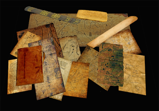
What else do the maps show?

As evidence in support of the French being singled out on updated information not only based upon the route they chose 20 some odd years after, but one such incident in history sticks out for me. The French and Italy had their ups and downs for some time, I’m sure this slowed them up a bit too. If one takes a look at all the early maps of the Americas one can see the lack of information regarding certain geographic areas, especially here in the west, it seems the French had “the lack of” information, case in point, the French Moll Map.


What exactly inspire Herman Moll a late 1600’s early 1700’s Cartographer and engraver we may never know, but the one map that catches my attention is his 1715 map wherein he incorporates the Baron Lahontan’s map of Lahontan’s account of the Long River, however there are two editions, in one version he uses Lahontan’s seeming poor rendition of the Lake at the head of this Long River, the other Moll Map uses what appears to be very nice a rendition from unknown origins showing conditions that had not existed for at least 1100 years! Without going back to read his account, if memory serves me, Lahontan claims the Indians somewhere near the Missouri and Mississippi river junction told him of this large lake at the head of this Long River and about the people who lived around it. This no doubt is the same Lake the Spanish wrote of several times over and depicted on their maps with what I would call great accuracy, but how would I know this if none of them including Lahontan never found this elusive lake?

Moll himself states on the map “A great part of this map is taken from original draughts of Mr. Blackmore, the ingenious Mr. Berisford, Captain Nairn and others never before published” What other maps was he talking about? The image he uses for the lake at the end of this long river which Lahontan never made it to, is a near perfect rendition of the intended lake at its higher elevations. How would I know this? We’ll get to that. But the point here is that it is clear to me that he was using older information that could only have come from maps or information with origins prior to about 900 AD which is likely the last time the lake was seen at this higher level reveling its very identifiable arm or bay to the east.

Part 1 and 2

Now what I am about to tell you is one of those things which I have kept back in most of my writings and it is concerning this lake and the Long River. It is virtually unknown and I know no other who has heard this nor considered it. To explain myself would require going back over nearly all of my writings, if you have not followed them then you are welcome to, if you have and have not picked up on the details yet, I do apologize for writing so tight lipped in the past.

The reason I have taken notice of Lahontan’s Long River story is that the Indians could not have told him about this lake as he claimed they did, Lahontan was clearly carrying information dating back prior to 900 AD. I say this because, prior to 900 AD back to the time of the Crucifixion and possibly earlier, the lake in which Scientist claim is 33 Million years old referred to as Lake Uinta, Takes the appearance of how it would have looked in its earliest times, some even say it existed 50 Million years ago. However looking at this rendition of this lake of which there is very little information regarding it, you would likely not consider it as a candidate of the elusive Lake Copala. This lake existed 2000 years ago and likely earlier until about 900 AD when a very large earthquake hit the Utah area; this is likely the earthquake responsible for what geologists call the Colorado Plateau uplift, Geologists claim it was formed some 20 to 70 Million years ago… I wish they would make up their mind...

Despite what geologist will tell you pertaining to these Colorado Mountains, “at least” the northern parts, did not exist in the days of lake Copala’s early days, Lake Coplala drained from two different effluents (Not necessarily at the same time), one to the south now regarded as the Green River and eventually joining the Colorado River, and it drained to the East and was at that time the head waters of what is now the Missouri River. At this early point of the Lakes Existence is the only time it would have taken upon the appearance shown in Herman Molls map, where did he get this from? In those days it was a beautiful lush and near tropical area. There is one other little secret, in these days when the river drained to the east out of the Uinta Basin, the river was known by the indigenous as Sidon, from this lake and all the way to the Gulf CoastSidon was the primary river of which fed the lower portion of Mississippi River, it was the predominant river prior to the destruction at the time of the crucifixion. Today we see the Mississippi all the way north as the main river as by all rights it today now is…

In about 900 AD there was an uplift of which geologist say it occurred 20 million years ago,  it lifted the near entire state of Utah which is consider the Colorado Plateau. This event cut off a large part of the source waters that fed this enormous lake, not to mention sent a wall of water south carving out another 1000 feet of the already existing Grand Canyon. At least the Northern parts of Colorado rose up and cut off the head drainage of the upper regions of what was known in BC times as Sidon. The Missouri was no longer the primary feed of the lower portion of today’s Mississippi river. The altering of the course of the river is plain to see even today, East and North East of St. Louis. The river today flows to the east of Saint Louis but on the west of East St. Louis. Before this, the river flowed on the east side of East St. Louis with its east bank at Caseyville. There was a well know ancient city known by certain circles in the days of Sidon, known to exist on the west side of this once great river, today its ruins are on the east side. This might explain why certain people have not yet found it across from Nauvoo Illinois, because it isn't there. 


After this great event of 900 AD and the dust settled, the once beautiful Lake, surrounded by 7 Cities now in ruin, was all but gone. Over the next 100 years what was once a lush beautiful tropic environment, began its transformation to the high country desert that it is today.

Why is it I seem so confident of this hypothesis? Because I took the time to consider what others would not let their mind set venture beyond. Despite the flawed Radio Carbon Dating System and those who believe the Uinta Mountains were once covered in an ice sheet from not only one Ice age, but a second one, this lake did not exist 50 million years ago, not even 1 million years ago.

Again, who discovered America? It sure wasn’t Columbus and the evidences show this land was known in the old world by some, as far back as King David if not earlier. Atlan, Atlan-tis, Affalon, Aztlan and Havilah are just a few of the names it has been known by. Just you wait till I write about Shambahla…or more accurately Shem-Bahla (Hindi, for Children of Shem) I’ll bet those who took the time to read this are now wondering where did all that water come from let alone, where did it go? but be patient, you will see, it is going to happen again… Isaiah 41:18