Originally Posted April 18th 2015
In light of recent events regarding the assassination attempt of the one man, if for real, could quite possibly return to office as the 17th de jure President of the FREE Republic, I feel compelled to post this again in hopes to help the reader understand more clear just exactly who and what we are up against... "they" have been here for a very long time, longer than you might think and most have never known or seen it... the objective is... just who and what is the Fed... what is Democracy and what happened to the Republic?
"In Saving the Union, I have destroyed the Republic, before me have I the Confederacy which I loathe, but behind me have I the bankers which I fear" Abraham Lincoln
Like it or not, Abraham Lincoln, the 16th and last de jure president of the Free Republic is also the first President to have commit Treason against the Free Republic...
April 9th 1865
In an effort to preserve Truth, and the History of this Nation which is clearly under attack, by foreign and domestic enemies, I write the following, it is not without error due to the weakness of the flesh, but I ask that you focus on the message and not the weaknesses of he who has presented it for consideration...
War is a terrible thing... War is never justified unless in self-defense from an encroaching seemingly unstoppable intended assault against natural God Given Rights, otherwise, war is never justified unless commanded of God, and to me these are truths.
There are certain principles as wrong as they may be and are from times of old, instituted by those who are the master manipulators, the conductors of war in bringing it about, Divide, Distract and Conquer, and if need be, Divide, Distract, and Conquer again. These concepts are as old as man himself.
Divide in this case means to divide the opinions, ideals, priorities and/or perspectives of men often through the controlled media to put them one against another, causing confusion, creating classes of individuals by various ways, especially the use of the all powerful words by labeling, this creates diversity which in turn when fed by the media of whatever source derived, leads to strife and eventually through the same media sources, war. Justification of accelerating the idea to the brinks of war is pushed by the predominate opinion receiving support of media and becoming the orthodox belief. ALL politicians and media who have at any time fomented the idea of a “Federal Democracy” in this nation, are guilty of Treason…
Distraction is now created by orchestrating events of happenings to give further justification of the predominant opinion, which is now a near orthodox belief. Remember the Main, the Twin Towers, the Oklahoma City bombings, and Pearl Harbor, just to name a few. Other more profound and noticeable distractions are created to keep the minds busy of those who fell for the fallacy, and to sway those who remained neutral with respect to the intended view, which usually becomes a popular belief, as no one wants to be a part of a losing team.
The Conquering is at this point, already in motion, yet war soon follows forcing false ideals upon those who did not fall for its trickery, making it a way of life becoming an orthodox belief.
Now comes the part in which my popularity will diminish as a result of truth being presented. First let me say, I love this country, I do not however love what it has become. People rant and rave, and are victims of distractions by delusions created about this great country, a free country, a land of opportunity the greatest nation on the planet and this is the delusion
Those who have been a part of our military whom I am grateful for, yet even many of them by the time they finish their tour of duty, see and feel something just isn’t right. There is a popular cliché that has grown by leaps and bounds in the past and today, and is quoted often as if it were true, this is the power of media and persistence. This cliché is promoted in several ways; one is often spoken by those who have served, in defense of the many who speak out against their actions, “I went to war to “defend” your freedom to be able to speak your mind.” They are convinced they were “defending” our freedoms of this country…while being… “Over There!”… in some other country.
You CANNOT DEFEND ANYTHING if you are not THERE to defend it! Ever since the First World War while our military was OVER THERE “defending” our country, evil men ambitious of power, foreign and domestic, have been HERE slowly stripping this nation of its freedoms. The only way to keep noble men from seeing the truth who are a part of our military is to keep them busy with distraction, because they WILL honor their oath, and to keep them from seeing or focusing on the foreign power or domestic enemy which has infringed upon the freedoms of America, and to keep them thinking they are involved in some noble cause “defending” our freedoms convincing them they are heroes, stroking their egos, while engaging in Wars… OVER THERE! And showering them with false concepts of honor, pride and decorating them with medals to justify what is blatantly wrong! How can you defend anything if you are not there defend it?
If these same brave men eager to defend and support their country knew that their employer was in fact not a government at all but a corporation set up to control the people of this nation for self gain, overthrowing the governments of other countries to set up their Federal Democracies and to take control of their fiat money systems in lieu of currency actually back by valuable substance such as gold… none who understood would support them.
Ever since the Civil War, NO MEN have fought in DEFENSE of this nation let alone its freedoms other than those who fought against the attack on Pearl Harbor, which was orchestrated in conjunction with the enemy as a distraction and justification of a much more heinous crime, annihilation of millions of people in Japan, all intended as a much larger demonstration of distraction. Why Pearl Harbor? Because it is the ONLY time since the civil war, I am aware of, in which an enemy came to the soil of American designated soil bringing war with them, and all the while, those whom the military are sworn to obey, were as much a part of the invasion as the enemy itself and in fact were the enemy!
An additional note here is, at this very time there is an enemy encroaching upon this very land, a Trojan horse if you will; largely built by the terrorist we wish we hadn’t known, Obama and his Muslims. If you believe that these historically known and devote Christian killers are “migrants” and that they pose no harm to you, you deserve what is coming as a result. A few years ago during the Obama Trojan Horse building, I saw a bill board indoctrination sign off the side of the freeway, in Provo Utah, It said “2.3 billion Muslims are against terrorism” Would this be like saying 2.3 Billion Demons are against evil? READ the Quran, KNOW thy enemy… Don’t be fooled people, Islam is now being used as a means to an end by an even more so wickedness, that of greed and lust for power. Satan is alive and well and he knows his time is short…. “My people perish for lack of knowledge”
My people are destroyed for lack of a knowledge: because thou hast rejected knowledge, I will also reject thee, that thou shalt be no priest to me: seeing thou hast forgotten the law of thy God, I will also forget thy children. (Hosea 4:6)
And then shall that Wicked be revealed, whom the Lord shall consume with the spirit of his mouth, and shall destroy with the brightness of his coming:
[Even him], whose coming is after the working of Satan with all power and signs and lying wonders,
And with all deceivableness of unrighteousness in them that perish; because they received not the love of the truth, that they might be saved.
And for this cause God shall send them strong delusion, that they should believe a lie:
That they all might be damned who believed not the truth, but had pleasure in unrighteousness. (2 Thessalonians 2:8-12)
The War of 1861
In short what the Civil War was about, was the exact opposite of what you have been taught. Rubbish you say? And my question is again, of what sources are your evidences to the contrary - but from the very books written by the carefully instructed liars, the designated historians of War. As always, history is written by the victors.
Let’s step back into time a little further, back to the days of the 13 colonies, suffering from the oppressions of King George. Although the pilgrims had left their mother land to escape captivity and bondage, the many atrocities of and the oppressions by the crown, continued. If I have to tell you the details of what occurred in 1776 when our founding fathers won their independence from the British crown, you just might need to go back to sleep. These people establish the Declaration of Independence to cast off those atrocities against their God given rights, and cast off “Bondage and Captivity” NOT SLAVERY.
The Israelites were not SLAVES they were in Bondage and Captivity, this means they had brought themselves into voluntary servitude to their masters by contract, a voluntary act in which the people were duped into giving up their freedoms. All because they received not the love of the truth, can it happen again? It would seem biblical scholars have been duped and have never explained why the Israelites were so reluctant to leave Egypt! When Moses showed up and announced he was going to lead them out of Captivity, (confined to unjust law) and Bondage (Contractual Agreements) they thought he had lost his mind, “But Moses, Why would we want to leave? These Egyptians are taking great care of us, why, we have our low income housing, Veteran loans, Welfare, food stamps, unemployment, Medicare, Medicaid, Social Security, Obama Care, Controlled Education, Head Start, a Special Milk Program and free cell phones! Why would we want to leave all this?” And when the people of this nation today are approached by one like unto Moses to lead them out of Bondage and Captivity, they are going to kick and scream because they have been lulled into the same carnal security.
You see, the best productive slave is one who does not know he is a slave, but if you put a fence around him and he will try to escape, but make him think he is free and shower him with benefits, and he will stay forever and even follow those sculpted to lead, even into battles of which we have no business…
The British Crown in 1776 didn’t take their rejection kindly in the years leading up to the War of Independence. Later they attempted again to bring these rebels back under the British elitist thumbs by force in 1812 when Nathan Rothschild didn’t get his charter in 1811, but not enough time had passed and the people were still very much awake, and once again the oppressors were booted out. The process of dumbing up the people had to begin, and it did under the guidance of the Crown by those most proficient at it; the wealthy elite, today regarded as world bankers, the very same people who were to become the private owners of the Federal Reserve.
Almost 50 years had gone by and the people fell sufficiently into carnal security, The united States was booming, Cotton in the South and industry in the North brought seeming prosperity. However Britain seeing the opportunity to divide, distract and conquer could not be made to look as a hypocrite and as a result enabled the Slavery Abolition Act of 1833.
Physical slavery in America was no more a pleasant thing than it was in England; Slavery was implemented by Spaniards and the French long before Africans were brought to America. Even though here in America, there were at one time as many slave owners in the North as was the South, the slave numbers increased in the south as this is where the Cotton grew and it was the largest growing crop in America. It was the heart of their growing livelihood. However, in the North the industrialist were busy with their inventions such as the cotton gin and other things. Industrialism was the heart of their livelihood, but who would buy them as long as the same job their machines were designed to do was done with free labor? Now I do not want to insinuate in the slightest that this was the cause of the Civil War. There were many other things which led to its beginnings. The Slave issue was used as a distraction and justification of the process of Divide, Distract, and Conquer. It was the perfect situation to use in the World Bankers’ plans in conjunction with bringing these rebels back under the crown. “Pay no attention to the man behind the curtain!” The people never knew what hit them, and the majority still don’t know.
Hypothetically speaking, let’s suppose the southern states were trying to implement into law the nonuse of cotton gins, making it unlawful to own one even in the North. Do you think the northern states, whose livelihood would have been under attack as a result, would have just stood by while congress enacted it into law? Well the Southern states were no different, but this is not what caused the seven congressmen from the southern states to walk out of a congressional session sine die prior to shots being fired in April of 1861.
Walking out of session sine die (Without setting a day to reconvene), by Law, meant Congress had ceased to exist, and by those same laws, in order to have a de jure government, a re-election of all government officials would have to be done, in other words, we were left without a de jure government and continued as a de facto government. Yes, there were many atrocities against the African slaves, cruelties of the worst kind. This sort of thing had been going on since the days Cortez first set foot in the Americas to subjugate the Native Americans. However, there were also many sympathizing Europeans from these early times who although they owned slaves, were good to their slaves, If this were not true, why is it in some cases that kidnapped slaves for the purposes of freeing them, escaped from their liberators, and returned to their owner with no other motive than to serve them. Why it is many slaves after being freed, stayed with their former owner to work on their plantation? What of the black slave owners? What of the various tribes in Africa who were kidnapping their own, and selling them to the Europeans? There are ALWAYS two sides to a story; however deception has only one side to tell.
History, or those who wrote it, would have you believe that the 13th Amendment and the 14th Amendment came about AS A RESULT of the war, and in this they deceive you whether they knew the truth or not. The 13th Amendment was the equivalency of preventing the North from manufacturing their cotton gins and making it unlawful to make them, of course this didn’t set well with the south whether they were good to their slaves or not. Why in God’s name would a people go to war, because they wouldn’t buy a damned cotton gin? Why would those of the South watch as the war progressed seeing their plantations burned to the ground, their women and children tortured, raped boarded up in their churches by Northern Soldiers and burned alive all because they wouldn’t free their slaves or buy a damned cotton gin which would have clearly increased their crop production and harvesting? Something stinks.
Now let’s look at the 14th amendment which was sitting on the table as well with the 13th Amendment in place on that congressional day… But first consider the “Father of the 14th Amendment” Mr. John Bingham. A pretty cozy and sympathetic story is told about this man, his poor condition, being impoverished etc… and his sympathy to his recently freed black friend, Mr. Titus Basfield, and of course you get perhaps one side of the story. I just read about him only moments ago, and I knew what I was looking for, and none to my surprise, I found it. It is the link between the framer of the 14th Amendment (John Bingham), and an individual linked to the World Bankers of the time, a friend of Mr. Salmon Chase. Yes the same family as founded the Chase Manhattan, Chase Banks, the very Chase whom Lincoln kicked out of his office when he offered to loan the United States money at 27%, and one of Jesse James’s least favorite people, I wonder why? Chase would later conveniently become the Secretary of the Treasury of the de facto government, and Chief Justice for the Newly Created Corporation, THE UNITED STATES in 1871. The World Bankers had just the right person[s] to help foment their plot.
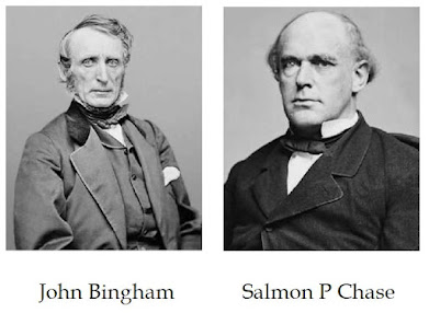
John Bingham and Salmon Chase are also two of the lesser involved suspect players in the assassination of Abraham Lincoln,
(SEE: The Assassination of Abraham Lincoln )
Now, Let’s pretend you are one of the Congressman of the south in 1861 and you are reading the proposed 14th amendment created by Salmon Chase of the World Bankers, er… I mean John Bingham, and just moments ago having read the 14th Amendment knowing that your livelihood has been severely affected, you likely would not be in the best of moods.
14th Amend Section 1
All persons born or naturalized in the United States, and subject to the jurisdiction thereof, are citizens of the United States and of the state wherein they reside. No state shall make or enforce any law which shall abridge the privileges or immunities of citizens of the United States; nor shall any state deprive any person of life, liberty, or property, without due process of law; nor deny to any person within its jurisdiction the equal protection of the laws.
Line 1 above, United States is with a capital U, this is not the former united states of America (proper upper and lower case) where in united is an adjective. However in the 14th amendment United States is a pronoun because it is the name of the new corporation which would eventually replace the now defunct free Republic government, you know, the one we swear allegiance to? Also notice the end words in line one “and subject to the jurisdiction” why did this have to be reaffirmed? you mean some were not? The first word, “persons” does not mean you or I, it means a corporate fiction, a nom de guerre, (the straw man) So this first line does not mean what you think.
Line 2, “are citizens” prior to this unholy document, Citizens with Constitutionally Protected rights, were with a capitol C as they were the superior to government having created it, however in this creation of the straw man by the foreign corporation, the voluntary member of this corporation or small c citizen is the now inferior. Continuing with line 2, of the United States (corporation) and the state where in they “reside,” people as in flesh and blood only reside when living somewhere other than their home, when a straw man is created, his home is Washington DC where the Corporation is, any other place where the actual flesh lives that has taken responsibility for the straw man, is the resident, reside means living somewhere other than your home.
Line 3, notice this new small c citizen, has no rights, he has privileges OR immunities, but the straw man has no immunities, therefore, he is left with privileges, today we call this civil rights, yet there are no rights and you cannot have BOTH Constitutionally Protected Rights, and at the same time have civil rights. Notice I have said “Constitutionally Protected” Rights as there is no such thing as Constitutional Rights.
Constitutionally Protected Rights are God Given Rights, these rights are UN alienable, which means NOT possible to transfer your rights, IN alienable (Chattel) simply means not at this time, transference of rights can be made possible.
Line 4, 5, and 6, persons have no life, liberty or property they have corporate rule, the equal protection is under UCC, Uniform Commercial Code, or (Contract Law) regulated by the Administrative Rules of Procedure created by Federal Law or Mans Law.
Section 2 is new rules to follow for the new corporation, Section 3 is some of the same other than I would like to point out, that a Federal Constitution or Constitution of the United States, is NOT the same thing as the Constitution of the Free Republic of the untied states of America (proper upper lower case).
Section 4 of the 14th Amendment is the structuring ground work of the Federal Reserve or the World Bank takeover of the peoples’ rights by voluntary action, which would eventually force their currency upon them rather than the use of silver and gold. Notice it says, “The validity of the public debt of the United States, authorized by law, ……. shall not be questioned.” ??? Why not?
Validity synonyms are, accuracy, authenticity, binding, lawful, legal, legitimacy etc… So as it would seem, deception and fowl play was in the works because if they were going to make a law wherein we could not question the validity of it, the implication is that it is most certainly going to be a counterfeit debt, illegal, illegitimate, unlawful, invalid, fake, or false debt (Opposing Antonyms)
The short story here is this, the 7 congressmen of the southern states saw what was actually happening - an attempt to over throw the Free Republic of America, it’s legitimate governing body, and replace it with a FOREIGN Corporation posing as a government, owned and headed by the British elite or World Bankers, all for the purpose of CREATING Slavery by way of Bondage and Captivity! In the war between the states, the SOUTH was trying to stop this overthrow of government by this foreign corporation, and creation of the straw man designed to be controlled by this foreign enemy, NOT the NORTH, the North was absolutely clueless to what was actually happening having been carefully indoctrinated with the falsehood that it was about freeing the physical enslaved man.
NOTE: replace the word Federal in all that you know and replace it with the word Foreign, and this is the truth!
President Lincoln is indisputably in his letter to Horace Greely:
“If there be those who would not save the Union, unless they could at the same time save slavery, I do not agree with them.”
“My paramount object in this struggle is to save the Union, and is not either to save or to destroy slavery. If I could save the Union without freeing any slave I would do it, and if I could save it by freeing all the slaves I would do it; and if I could save it by freeing some and leaving others alone I would also do that. What I do about slavery, and the colored race, I do because I believe it helps to save the Union; and what I forbear, I forbear because I do not believe it would help to save the Union. I shall do less whenever I shall believe what I am doing hurts the cause, and I shall do more whenever I shall believe doing more will help the cause."
Why was Lincoln so concerned with the Union, even to the point of committing treason against the Free Republic of America? We were not currently at war with any foreign nation.
He is also quoted, but denied of course by the academic, as saying: "In Saving the Union, I have destroyed the Republic, before me have I the Confederacy which I loathe, but behind me have I the bankers which I fear"
Why would Lincoln fear the bankers? I wonder… Why did Jesse James and the Confederacy always target the corporations, especially those owned by or connected with ANY of the world bankers? Why was Lincoln concerned for the Union, when we were not under attack by way of arms of a foreign country, and if we had come under attack by gun fire, I guarantee the southern states and the northern states would have once again joined forces in an effort to defend American soil… HERE… on this American soil.
President John F. Kennedy is quoted yet also denied by the academic as saying: "The high office of the President has been used to foment a plot to destroy the freedoms of America and before I leave this office, I must inform the citizens of their plight." 10 days later he was dead, and Hillary Rodham, still being groomed, was only 16 years old!
Why would JFK say this? Well you now know… but, it is a well known fact that Kennedy had every intention of ridding America of the unholy Federal Reserve Bank.
THIS IS WHAT THE CIVIL WAR WAS ABOUT!
The south was trying to save the Republic! Not the damned Union! They were the HEROES! and despite the conflict of their own brothers from the north STILL gave their lives to repel this invasion of our country, THESE ARE THE PEOPLE who DEFENDED this country along with those of the Revolution, These are the people who fought for our FREEDOMS, and NONE OTHER.
The Pledge of Allegiance (of which a majority get their panties in a wad over) - what do you know of it? It was originally written in 1887 but was revised and finally adopted by CON-gress in 1945.
“I pledge allegiance to the flag, (an inanimate object) of the UNITED STATES of America, and to the what????? How many of you said Federal? How about Democracy? Federal Democracy maybe? Republic you say? My question to all of those same people is…. What Republic? Where is it?
And what Flag is it they are swearing this allegiance to? Is it the flag of the Republic? Last seen in the 1860’s or the NEW Corporate Flag of this Foreign entity, this Foreign and yet Domestic Enemy, those whom the enlisted of the Military have sworn to protect us from? This flag of the UNITED STATES (Corporation) the American population pledge before this day, was created out of Title 4 USC 1 in 1947 and is an imposter! It IS NOT the flag of the Republic last seen in 1861 with 34 stars, It is the flag of the CORPORATION! Identified in part by the yellow fringe, Maritime Law, Law of the Sea, The Great Leviathan! The very foreign power which has overthrown our Free Republic, our country and our land and is quickly eroding away our freedoms.
What are the differences between a true Republic and a true Democracy? In 1928 they knew! Why don’t we?
From the 1928 soldiers training manual:
Democracy:
A government of the masses. Authority derived through mass meeting or any other form of "direct" expression. Results in mobocracy. Attitude toward property is communistic--negating property rights. Attitude toward law is that the will of the majority shall regulate, whether is be based upon deliberation or governed by passion, prejudice, and impulse, without restraint or regard to consequences. Results in demogogism, license, agitation, discontent, anarchy
Republic:
Authority is derived through the election by the people of public officials best fitted to represent them. Attitude toward law is the administration of justice in accord with fixed principles and established evidence, with a strict regard to consequences. A greater number of citizens and extent of territory may be brought within its compass. Avoids the dangerous extreme of either tyranny or mobocracy. Results in statesmanship, liberty, reason, justice, contentment, and progress. Is the "standard form" of government throughout the world. A republic is a form of government under a constitution which provides for the election of (1) an executive and (2) a legislative body, who working together in a representative capacity, have all the power of appointment, all power of legislation, all power to raise revenue and appropriate expenditures, and are required to create (3) a judiciary to pass upon the justice and legality of their government acts and to recognize (4) certain inherent individual rights.
Take away any one or more of those four elements and you are drifting into autocracy. Add one or more to those four elements and you are drifting into democracy.
Why didn’t Martin Luther KING contend in behalf of the African Americans for Constitutionally Protected Rights? Because they were not available to them. This is why he contended for any rights of which only civil rights were available and which can be bartered or taken away and are NOT rights at all! All King did was bring the African origin people back into slavery, but without the chains… Blaming the South, the Confederacy, for Slavery is ignoring the facts! Why don’t we blame the Spanish and Portuguese who purchased the Slaves. Why don’t we blame other African tribes who captured and sold their own people to the Spanish, Portuguese and British!
Yes the war between the states took the shackles and chains off from the physical slaves, but they immediately fell back into slavery by way of bondage and Captivity along with all other Americans. THIS IS WHAT Jesse James and the Confederacy were fighting against, to keep America free, freedom from foreign powers, freedom from taxation us a result of the use of a currency they were forced into using, freedom of religion, especially free from interference to regulate religion of which today there is no 501(C)(3) religion free from interference. You are free to worship your God, according to the dictates of Caesar. Freedom to own land in Allodial title and free from taxation, freedom to own a automobile without registration DOESN’T EXIST any longer thanks to the Northern puppets! You think you own your property? THINK again! Stop paying the tax and the real owner will soon show up, “but I have the title to my truck you say”… No you don’t, that is a CERTIFICATE of Title, where is the title? The pink slip?
I suppose as long as you think you are free then all is well in Zion, but it needs to be understood, at the time of the Civil War, this country’s government, the Free Republic of America was utterly overthrown and wasted… and the southern states tried to stop it.
An interesting prophecy
On the head of Judge Douglas.
This one is for my many friends who are of the (LDS) Mormon Religion belief. I became aware of this prophecy many years ago, since then, I have sought after ANY written text whatsoever where in ANY authority or representation of these people has addressed this prophecy for authentication, only to find NONE! There have been some attempts to at least explain the first part of this purported prophecy which was not necessary as history has already stood as a witness. BUT WHY… has none of the Scholars, these so called educated men, those who should know, those you would expect to know, NEVER addressed the Overthrow of our government and why have they left it to their own oppressors the anti Mormons, to taunt them and believe it is a false prophecy because it is left unaddressed - the public being left believing it is a false prophecy because according to them, it didn’t happen.. but I am sorry to say It most certainly did.
The Prophecy on the Head of Stephen A. Douglas From the Teachings of the Prophet Joseph Smith, Section Six 1843–44, p.302
The following brief account of the Prophet's visit with Judge Douglas while at Carthage is from the journal of William Clayton, who was present. For the fulfillment of this prophecy the reader is referred to the comments in the Documentary History of the Church, 5:395-398.
NOTE: don’t waste your time looking up the Fulfillment of this prophecy in the Documented History as there is no “fulfillment” given. NOT ONE WORD is attributed to the Republic being over thrown and wasted, the entire article is a carefully written document to divert you from an answer, keep you from asking why? They could not answer that part of the prophecy in 1902, because they did not know… WHY?
(1843) Dined with Judge Stephen A. Douglas, who is presiding at court. After dinner Judge Douglas requested President Joseph to give him a history of the Missouri persecutions, which he did in a very minute manner, for about three hours. He also gave a relation of his journey to Washington city, and his application in behalf of the Saints to Mr. Van Buren, the President of the United States, for redress and Mr. Van Buren's pusillanimous reply, "Gentlemen, your cause is just, but I can do nothing for you;" and the cold, unfeeling manner in which he was treated by most of the senators and representatives in relation to the subject, Clay saying, "You had better go to Oregon," and Calhoun shaking his head solemnly, saying, "It's a nice question—a critical question, but it will not do to agitate it."
The judge listened with the greatest attention and spoke warmly in deprecation of the conduct of Governor Boggs and the authorities of Missouri, who had taken part in the extermination, and said that any people that would do as the mobs of Missouri had done ought to be brought to judgment: they ought to be punished.
President Smith, in concluding his remarks, said that if the government, which received into its coffers the money of citizens for its public lands, while its officials are rolling in luxury at the expense of its public treasury, cannot protect such citizens in their lives and property, it is an old granny anyhow; and I prophesy in the name of the Lord God of Israel, unless the United States redress the wrongs committed upon the Saints in the state of Missouri and punish the crimes committed by her officers that in a few years the government will be utterly overthrown and wasted, and there will not be so much as a potsherd left, for their wickedness in permitting the murder of men, women and children, and the wholesale plunder and extermination of thousands of her citizens to go unpunished, thereby perpetrating a foul and corroding blot upon the fair fame of this great republic, the very thought of which would have caused the high-minded and patriotic framers of the Constitution of the United States to hide their faces with shame. Judge, you will aspire to the presidency of the United States; and if ever you turn your hand against me or the Latter-day Saints, you will feel the weight of the hand of the Almighty upon you; and you will live to see and know that I have testified the truth to you; for the conversation of this day will stick to you through life.
He [Judge Douglas] appeared very friendly, and acknowledged the truth and propriety of President Smith's remarks. (May 18, 1843.) DHC 5:393-394.
WHY is this most profound part of this purported prophesy, following the evident words, “I prophesy in the name of the Lord God of Israel,” IGNORED? Why has no one of authority ever addressed this? I have already answered… They did not know it happened, WHY?
Steven A. Douglas died June 3rd 1861 just two months after the first shots were fired April 12th 1861 at Fort Sumpter, by Captain George S. James, the Father of Jesse James himself. Judge Douglas did aspire to the presidency.
The Government of the day being the free Republic, NEVER redressed the wrongs committed against the Saints. This leaves the Mormons in a seeming bad position because the majority are convinced that the government has never been over thrown. Apologists will mention Judge Douglas aspiring to the presidency, but none I have found will touch it with a forty foot pole, the most profound part about the government being overthrown and wasted. Why, Why, Why?
If you didn’t get it in previous parts, the Civil War involved 3 players, the North, the South, and the World Bankers, our government being the Free Republic, was without doubt, utterly overthrown and wasted and replaced with a corporation created by these same world bankers finalized in 1871 and called this corporation the UNITED STATES, in order to keep you in the dark as to what happened, they have also used the format of our flag of the free Republic to give you a visual symbol to make you feel all safe and secure, we have not had a legitimate President of the united States of America under the Free Republic since our 18th president, 1871.